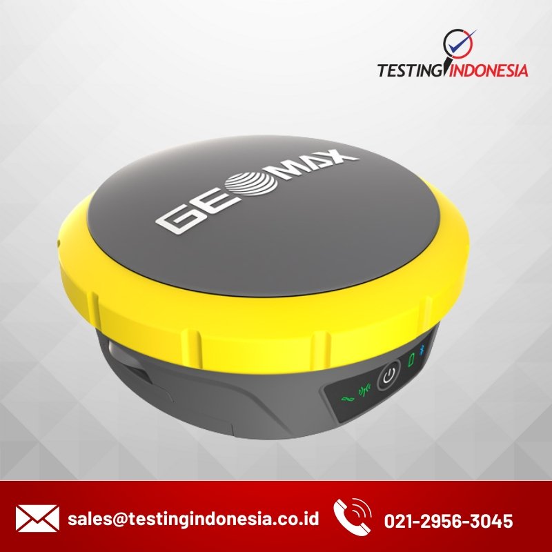
Zenith60 Pro

Redefining Accuracy and Reliability

Category: Tag:

Description

For surveyors and construction professionals who want to get the job done on time and with confidence, the advanced Zenith60 Pro GNSS smart antenna ensures precise, accurate, and hassle-free measurements. Whether working under dense canopy, in urban canyons, or on construction sites, this high-performing RTK rover provides reliable data in challenging conditions. Integrated into the world of GeoMax X-PAD software keeps you covered with intuitive workflows and easy data exchange from measuring to processing to help you get maximum results in minimum time.

Optimised performance

The new, powerful RTK rover provides high quality data and supports a streamlined workflow. The Zenith60 Pro‘s tilt compensation makes it possible to measure otherwise inaccessible points and increases your measurement speed and accuracy.

Boosted efficiency for your digital workflow

Zenith60 Pro is fully integrated with the GeoMax ecosystem, providing a comprehensive solution that works when you do. Zenith60 Pro connects with GeoMax total stations and innovative X-PAD field software that enables an efficient and flexible workflow. X-PAD Software provides a simple user experience without extra software maintenance costs.

Reliable even under canopy

Face any challenge and have your job done with the new Zenith60 Pro. Whether it’s harsh climate, urban areas, dense canopy coverage, or other challenging terrains, the Zenith60 Pro helps you overcome obstacles with minimal effort.

Welcome to the connected world of GeoMax software and support

Make the most of the Zenith60 Pro by connecting into the world of GeoMax’s standout software and support for a unified solution to your individual needs.

The GeoMax X-PAD Software Suite covers all the stages of a construction project, from design to plan and build. It is tailored for projects that require capturing accurate data in the field, transferring it quickly and securely to the office, storing and managing files on a single platform, post-processing GNSS static data, and more.

The Suite includes X-PAD Ultimate, the dedicated GeoMax field software for GNSS antennas and total stations featuring straightforward workflows on site.

X-PAD Office Fusion combines all your geospatial data from GeoMax sensors, laser scanners, and drones in one environment, enabling you to create your project deliverables, while X-PAD 365 cloud platform empowers synchronised collaboration, file management, and notifications.

Additionally, as part of the GeoMax family you are connected to a range of resources for real-time support and on-demand subject training from our Training Academy.

Features

Optimised performance
  • New powerful RTK rover provides high quality data.
  • Calibration-free tilt compensation increases measurement speed.
  • Electromagnetic resistance.
Reliable even in challenging conditions
  • Performs reliably even under dense canopy.
  • Multi-constellation and multi-frequency support continuous, accurate coverage.
  • Robust and durable (IP68)
Boosted digital dataflows
  • Comprehensive solution, fully integrated into the GeoMax ecosystem.
  • Streamlined connection with X-PAD field software, total stations, and field controllers.
  • Free field software updates for up to date operation.

Spesification

Finish jobs on time and with confidence using the Zenith60 Pro GNSS smart antenna, enabling accurate, reliable, and hassle free measurements. Whether working under dense canopy, in urban canyons, or on construction sites, this high-performing RTK rover provides reliable data in challenging conditions. Integrated into the world of GeoMax, X-PAD software keeps you covered with intuitive workflows and easy data exchange from measuring to processing to help you achieve maximum results in minimum time.
VARIANTS4G LTEUHFTILT COMPENSATION
GeoMax Zenith60 Pro LTE-IMU -
GeoMax Zenith60 Pro LTE-UHFIMU
RECEIVER SPECIFICATIONS
Measurement Engine800+ channels, multi-frequency, multi-constellation
GPS trackingL1 C/A, L1P, L1C, L2C, L2P, L5
GLONASS trackingL1 C/A, L1P, L2 C/A, L2P, L3** 
BeiDou trackingB1l, B1C, B2l, B2a, B2b, B3l, ACEBOC
Galileo trackingE1, E5a, E5b, E6, AltBOC
QZSS trackingL1 C/A, L1C, L2C, L5, L6
NavICL5
SBAS (EGNOS, WAAS, MSAS, GAGAN)L1, L5
Positioning rate20 Hz
Time for InitialisationTypically 4s
QUALITY MODE
RTK modesSelectable; Surefix, Standard
Tilt CompensationCalibration-free, Resistant to magnetic interferences
COMMUNICATION
4G LTE moduleQUECTEL EG25-G LTE FDD, LTE TDD, UMTS, GSM
RTK data protocolsRTCM 2.1, 2.3, 3.0, 3.1, 3.2, 3.3, 3.4, CMR, CMR+
NMEA OutputNMEA v3.1, NMEA v4.1
UHF radio moduleSATEL TR4+, 500 mW, 1000 mW transceiver, 403–473 MHz
Bluetooth®2.1 +EDR, V5.0 QR-iConnect functionality
WLAN802.11 b/g/n Hotspot / client mode
TNC connector UHF antenna
Communication portUSB, serial & power
RECEIVER ACCURACY & PERFORMANCE * 
qqewq   ,Hz: 8 mm + 1 ppm (rms)  V: 15 mm + 1 ppm (rms)
Network RTKHz: 8 mm + 0.5 ppm (rms)  V: 15 mm + 0.5 ppm (rms)
StaticHz: 3 mm + 0.5 ppm (rms)  V: 5 mm + 0.5 ppm (rms)
Static longHz: 3 mm + 0.1 ppm (rms)  V: 3.5 mm + 0.4 ppm (rms)
Tilt compensated real-time kinematicAdditional Hz uncertainty 2 cm up to 30° tilt 
INTERFACES
KeyboardOn/Off button
LED status indicatorsPosition, RTK, Power, Bluetooth®
Data recordingDual; microSD card and 8 GB internal memory
LTE/TCP/IPRemovable SIM card
POWER SUPPLY
Two internal batteriesHot-swappable, Li-Ion 3.4 Ah / 7.2 V
Operating time12.5 h in static / 11 h in rover mode 
External power9 V to 28 V, LEMO® plug
PHYSICAL SPECIFICATIONS
DimensionsHeight 75 mm, ø 166.8 mm
Weight1.14 kg without batteries
Operating temp. –40°C to 65°C
Environmental protectionIP68 (IEC 60529)  Withstands powerful jets and temp. immersion under water  MIL-STD-810G 1 506.6 & 1 512.6  Fully dust tight  MIL-STD-810G 1 510.6
HumidityMIL-STD-810H 1 507.6
Vibration Mechanical stress resistant according to ISO 9022-36-05
ShockWithstands 2 m drop onto hard surface
  * Measurement accuracy and reliability are dependent on various factors including satellite geometry, obstructions, observation time, ionospheric conditions, multipath, etc.  ** Glonass L3 will be provided through future firmware upgrade.  Figures quoted assume normal to favourable conditions. GeoMax reserves the right to change, without notice, product offerings or specifications.

Download Catalogue

GNSS Receiver Zenith60 Pro-REF
 

Reviews

There are no reviews yet.

Be the first to review “Zenith60 Pro”

Your email address will not be published. Required fields are marked *